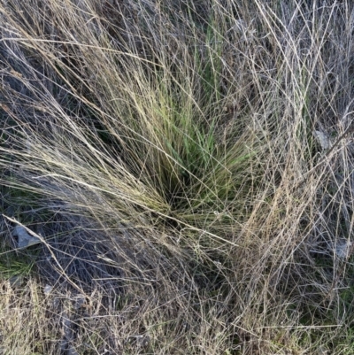
Serrated Tussock at Watson, ACT
Identification history
| Nassella trichotoma | 25 Apr 2023 | waltraud |
Identify this sighting
Please Login or Register to identify this sighting.
User's notes
6 ST close to fence cut and sprayed with Glypho (1:100); small ST in the vicinity may have been overlooked - ST was not target.
4 comments
Mike
wrote:
25 Apr 2023
I thought you were going to use Field Maps for ST 🙂.
Good work in treating it. Overwhelmed in Isaacs/Mugga.
Good work in treating it. Overwhelmed in Isaacs/Mugga.
waltraud
wrote:
25 Apr 2023
Mike, yes we use Feld Maps for mapping particularly WoNS , however, reporting on Field Maps hasn't (always) attracted the attention of PCS in the past, although reports on Bridal Creeper, Fireweed and Gorse have attracted the attention of the Biosecurity team. We on't know whether the mapping of other WoNS such as ST, CNG, ALG and Blackberry is a waste of our time. In the past ALG, CNG, ST, and Blackberry fell through. Slashing of the invasive grasses occurred at peak seed time of ALG and CNG ensuring a widespread of the species and we have the feeling, that PCS ignores StJW entirely (there are large StJW sites and it takes our members a long time to walk and to stream the sites). So we sometimes double up taking photos to show the WoNS in "flesh" and provide some documentation of the situation. We do not know what happens with all our Field Map reporting work of the past when no action was taken - at least we have CNM photos to show...
Mike
wrote:
25 Apr 2023
Something for our representative on the Invasive Plants Action Group to take up.
waltraud
wrote:
25 Apr 2023
Definitely Mike. I think the staff and resource situation at PCS is ridiculous and responsible for ineffective management such as slashing ALG, CNG etc at peak seed time - no one seems to have time to check Field maps or the weeds in situ and work appears uncoordinated and ad hoc which leads to the further spread of weeds. Parkcare volunteers jump up and down, record the weeds, take photos, and report on Field maps or on CNM... but sometimes you get the feeling volunteers are considered a nuisance.
Please Login or Register to comment.
Nearby sightings
1 2
Location information
- Coordinates 149.169022-35.226514
- Altitude 619.1m
- Maps The Fair, Watson Mount Majura
- Places Watson, ACT
Sighting information
- 6 Abundance
- 24 Apr 2023 10:49 AM Recorded on
- waltraud Recorded by
Additional information
- 10cm to 30cm Plant height
Species information
- Nassella trichotoma Scientific name
- Serrated Tussock Common name
- Not Sensitive
- Exotic
- Severe weed or pest
- Up to 1360.74m Recorded at altitude
- 734 images trained Machine learning
-
In flower
- External link More information
Record quality
- Overall Fit for scientific/research use
- Images or audio
- More than one media file
- Verified by an expert moderator
- Nearby sighting(s) of same species
- GPS evidence of location
- Description
- Additional attributes


