How to contribute
It's easy to upload your own sightings to NatureMapr from a smartphone or digital camera!
To get started, simply register an account and then choose one of the following upload methods:
Method 1 - NatureMapr data collector app for smartphones (Easiest)
The NatureMapr data collector app is a freely downloadable app that is used for data collection only - that is, to record and upload your sightings to NatureMapr.
iPhone
Download the NatureMapr iPhone App
Android
Download the NatureMapr Android App
Other smart phones
Photographs taken from any smartphone with GPS location enabled can be emailed to a PC and uploaded to NatureMapr from there. This method also works on iPhone and Android if you don't have the app.
Method 2 - Cameras with in-built GPS
Many modern digital cameras feature an in-built GPS location sensor. If your camera has one, then simply:
- Ensure the GPS feature is enabled in your camera's settings
- Photograph your sightings
- Transfer your photographs to a PC and upload them via the NatureMapr web site
For tips on how to take great photos of plants and animals, see our DSLR photography guide by Tim Leach.
Method 3 - Cameras without GPS
If your digital camera does not have an in-built GPS location sensor, you can use the GPS location sensor on your smart phone to record the location information and overlay it back onto your camera's photographs at a later time.
To use this approach, you need two pieces of software:
- An app on your phone to record your location into GPX format: (GeoTagr for iPhone)
- Software on your PC to overlay GPX information onto your images: (GeoSetter for Windows)
Once you've embedded the location information onto your images, you can upload them via the NatureMapr web site.
For tips on how to take great photos of plants and animals, see our DSLR photography guide by Tim Leach.
Method 4 - Manually specify location
If you don’t have a GPS enabled phone or camera, or if you have old photos from a pre-digital camera, you can upload them via the NatureMapr web site and specify the location manually.
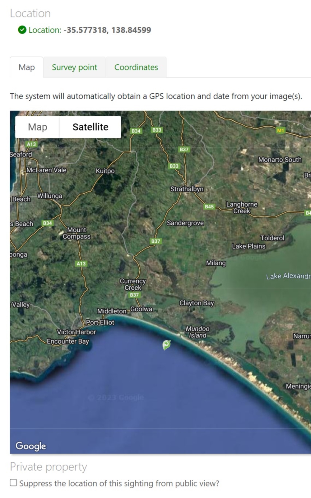
To do this, you can click a location on the Google Maps aerial photograph or you can specify latitude and longitude coordinates manually.

Note: This method will result in a reduced data quality score for your record as there is no GPS based evidence of the sighting's location.
Still having issues?
If you are still experiencing issues or are unable to successfully upload your sightings, please see our Frequently asked questions page.

